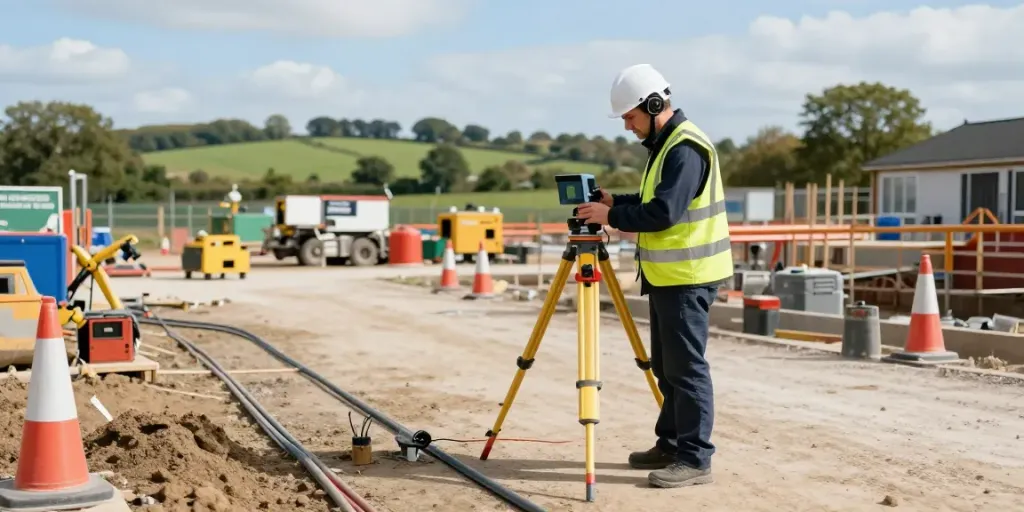
Understanding Utility Surveys: The Basics
Utility surveys are a critical component of modern construction and infrastructure projects. They play a vital role in ensuring safety, efficiency, and compliance throughout the project lifecycle. By accurately mapping underground utilities, stakeholders can avoid costly accidents, delays, and damage to essential services. In the UK, particularly in areas like Surrey, the demand for reliable Utility Survey Surrey services has been growing, driven by an increasing array of urban developments and infrastructure upgrades.
What is a Utility Survey?
A utility survey is a detailed investigation that identifies and maps underground utilities such as pipes, cables, and other infrastructure. This process typically employs various techniques including Ground Penetrating Radar (GPR), Electromagnetic Location (EML), and Vacuum Excavation. The primary aim is to gather accurate data about existing utilities to inform construction and excavation projects, ensuring that all stakeholders have the necessary information to proceed safely.
Importance of Utility Surveys in Construction
In construction, understanding the location and depth of underground utilities is essential. Lack of accurate data can lead to:
- Accidents and Injuries: Striking a gas line or electrical cable can result in severe injuries or fatalities.
- Project Delays: Unexpected utility discoveries can halt progress, leading to increased costs and extended project timelines.
- Legal Implications: Failing to conduct a comprehensive utility survey may result in liability issues for contractors.
Therefore, utility surveys are not just a precaution; they are a necessary step in safeguarding both personnel and infrastructure.
Key Technologies Used in Utility Surveys
Several advanced technologies are used in utility surveys, including:
- Ground Penetrating Radar (GPR): Utilises radar pulses to image the subsurface, providing detailed information about utility locations and conditions.
- Electromagnetic Location (EML): Uses electromagnetic fields to detect buried conductive materials, including various metallic utilities.
- Laser Scanning: Captures precise measurements of surface features, aiding in identifying surface indicators of buried utilities.
These technologies have revolutionised the way utility surveys are conducted, allowing for greater accuracy and reduced timeframes.
Choosing the Right Utility Survey Service in Surrey
When it comes to utility surveying, selecting a reputable service provider is paramount. The landscape in Surrey is dotted with numerous surveying companies, each offering various capabilities and technologies. Here are some tips to consider while evaluating potential providers.
Evaluating Service Providers: What to Look For
When assessing utility survey services in Surrey, keep the following criteria in mind:
- Experience: Look for companies with proven experience, particularly in projects similar to your own.
- Technology: Ensure the provider employs up-to-date technology such as GPR and EML, which enhance survey accuracy.
- Compliance: Confirm that the service complies with industry standards, such as PAS 128, which outlines best practices for utility mapping.
Benefits of PAS 128 Compliance for Your Project
PAS 128 provides a framework for conducting utility surveys, ensuring that the information collected is reliable and useful. Benefits of working with PAS 128 compliant services include:
- Standardisation: Consistent quality in survey results across different providers.
- Improved Communication: Clear guidelines enhance communication between stakeholders, minimising misunderstandings.
- Enhanced Safety: Adherence to standards reduces risks associated with utility strikes.
Questions to Ask Potential Surveying Companies
When contacting potential surveying companies, consider asking the following questions:
- What technologies do you use for your surveys?
- Can you provide references from previous clients?
- How do you ensure compliance with industry standards?
- What is your approach to ensuring data accuracy and reliability?
Common Challenges and Solutions in Utility Surveying
Utility surveying can be fraught with challenges. Understanding these challenges and knowing how to navigate them is crucial for project success.
Identifying Underground Utilities: Common Misconceptions
Many believe that simply using GPR is sufficient for all surveying needs. However, misconceptions abound, including:
- GPR can see all utilities regardless of type or material.
- Surveys can be completed quickly without thorough site preparation.
In reality, different utilities require different methods for detection, and thorough planning is essential for accurate results.
Overcoming Obstacles During Utility Surveys
Challenges such as inaccessible areas, poor soil conditions, and existing disturbances can complicate utility surveys. Solutions include:
- Utilising various survey techniques to confirm findings.
- Preparing a comprehensive site assessment before conducting surveys.
- Collaborating with local authorities to access restricted areas.
Real-World Case Studies of Utility Survey Success
Several projects across Surrey exemplify the importance of effective utility surveying. For instance, a recent infrastructure upgrade in a busy urban area was completed smoothly after thorough utility surveys identified numerous buried utilities, allowing for careful planning and execution. The project saved significant time and costs due to the advance knowledge of potential obstacles.
Best Practices for Effective Utility Surveys
Maximising the success of utility surveys requires adherence to best practices that ensure data accuracy and reliability.
Guidelines for Accurate Data Collection
Follow these guidelines to achieve optimal results:
- Prepare Thoroughly: Assess the site and review existing records to identify potential utility conflicts.
- Use Multiple Technologies: Cross-verify findings using different survey methods to enhance accuracy.
- Keep Detailed Records: Document all findings and methodologies used during the survey for future reference.
Tips for Successful Communication with Stakeholders
Effective communication is key to successful projects. Consider these tips:
- Establish Clear Channels: Set up defined communication lines with all stakeholders involved.
- Provide Regular Updates: Keep everyone informed on the progress and findings during the survey.
- Encourage Feedback: Create an environment where stakeholders can share concerns or suggestions regarding the surveying process.
Utilising Technology for Enhanced Survey Accuracy
Integrating advanced technologies can significantly improve survey outcomes. For example:
- Real-time data collection allows for immediate analysis and decision-making.
- 3D mapping capabilities enhance visualisation of complex utility networks.
Future Trends in Utility Surveying for 2026
As we look towards 2026, several trends are set to shape the future of utility surveying.
Emerging Technologies to Watch
Anticipated technological advancements include:
- Artificial Intelligence (AI): AI can be used to analyse survey data more efficiently, identifying patterns that could indicate utility locations.
- Internet of Things (IoT): IoT devices can facilitate real-time monitoring of underground utilities, improving maintenance and reducing response times to issues.
Environmental Considerations in Utility Surveys
As environmental concerns rise, utility surveying practices will need to adapt. This includes:
- Incorporating sustainable practices in surveying methodologies.
- Prioritising non-invasive survey methods to minimise environmental impact.
Preparing for Future Regulations and Standards
As regulations evolve, staying ahead of industry standards will be crucial. Ensuring compliance will not only protect projects from potential legal issues but will also promote safety and efficiency in utility management.
How much does a GPR survey cost?
The cost of Ground Penetrating Radar surveys can vary widely based on factors such as site location, complexity, and the specific technologies used. On average, businesses should expect to budget anywhere from £500 to £1,500 for basic surveys, with more complex investigations potentially incurring higher costs.
What is a utility survey?
A utility survey is a method of mapping underground utilities to assist in construction and excavation projects. By identifying the locations and types of utilities, these surveys help prevent damage and ensure the safety of construction crews and the general public.
Can I do my own boundary survey?
While it may be possible for property owners to carry out a basic boundary survey, professional surveying is recommended due to the complexities involved and the potential legal ramifications of inaccuracies.
Who can mark underground utilities?
Only certified and trained professionals should mark underground utilities. These professionals employ specific techniques and technologies to ensure accurate identification and mapping, which is crucial for maintaining safety on construction sites.
What are the benefits of PAS 128?
PAS 128 compliance offers numerous benefits, including standardised procedures for utility mapping, improved safety, better communication among stakeholders, and increased trust in the accuracy of survey data.